WINTER OUTLOOK 2023 IS NOW LIVE

The 2023 Winter Outlook

Friday, February 26, 2021

Friday: Worst of Winter Over, A Few Wildcards Left

 Good morning. From my observations the worst of winter is now behind us. Temperatures have been moderating and the chances of snow will be diminishing especially by week two of March. However, there still is a period next week we need to get through that still can produce some winter weather. I would call it more of a wildcard right now as the pattern is pretty chaotic. 

Over the next week expect a lot of ups and downs. A chilly day today then rain moves in tomorrow morning which could mix with some snow initially to the northwest. We then hit a very up and down week next week. There is an outside chance a storm can develop around the Wednesday-Thursday timeframe.

Lets take a look...

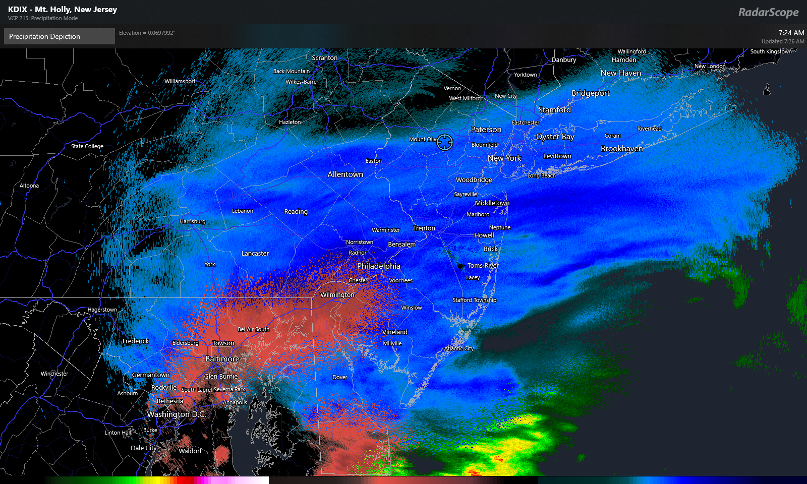
Colder air in place today, then a storm attacks the cold from the southwest later tonight...


This is over by early afternoon Saturday. Another wave of rain moves in Sunday afternoon as a cold front hits the area...


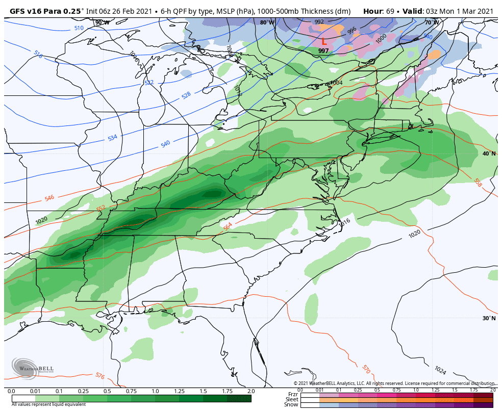
Monday and Tuesday are then colder days. We then need to watch how this cold behaves with another few pieces of storm energy middle to end of next week. Some models indicate the cold gets pushed out again while other suggest it may stay locked into allow snow around the Wednesday or Thursday timeframe...


The European is most aggressive with this and it is due to the upper air pattern supporting the cold locking in due to a strong block over Greenland...


Other models not as impressed with this. March is always a crazy month and we usually do not escape the first half without a few surprises. Stay tuned. 


Wednesday, February 24, 2021

Wednesday: Winters Final Innings, Not Over Yet

 Good morning. It has been a pretty incredible and historic stretch of winter. In Randolph NJ we have had over 50" of snow this month alone! It is like being in VT in NJ.

Looking ahead the next two days warm up in many spots with temps in the 40s. This along with the late February sun will start to melt our snowpack. We do have a short spurt of colder air on Friday into Saturday. A wave of low pressure will try to develop on the back of this cold air on Saturday. This means some winter precipitation for areas of the interior Saturday.

We then have the arrival of  a very cold air mass early next week. We need to look for storm development on the front end of this on Monday then again a potential bigger storm system on Wednesday. Nothing is a guarantee I am just breaking down what I see in terms of pattern potential.

Lets take a look...

We have a surge of warm air today and Thursday before our next quick injection of cold arrives on Friday..


A storm system will then attack this cold air on Saturday and cause rain for areas near the coast and some snow to the interior. However,  it appears the cold will not hold and snow changes to rain even in New England...


Some accumulating snow can occur before this happens even in NW NJ and NE PA but I wouldn't count on that.

We then have our next shot of cold air early to middle of next week as a part of the polar vortex swings through.  You always look for storm development on the front and back end of these cold spells...

On the front end, there is a small chance we see something develop but I would be more focused on the back end of this outbreak around the March 3rd timeframe...

I am not going to show surface projections yet because the models are too consistent. What I will show is the pattern below for middle of next week...


What you are looking at above are a few puzzle pieces I like to see on a map for potential storm development. The key here is that vortex of cold air that will swing through then possibly settle off the coast of eastern Canada. If that happens, it can lock in some cold air and allow a storm to amplify near the east coast around March 3rd. 

Thats all there is to really say for now. I will be monitoring these variables. 


Monday, February 22, 2021

Monday Morning: Forecast on Track, Intense Burst of Snow Today in High Terrain

 Good morning. My forecast is on track. There will be a short (few hours) but intense burst of snow that arrives into the region around 11am and lasts into mid afternoon. For areas in the higher elevations of NW NJ, NE PA and New England expect several inches to accumulate. This is where the biggest impacts will be today

For areas in lower lying areas, expect some accumulation on grassy surfaces but the temps should stay above freezing. Snow will also change to rain in those areas. My map below reflects this...


Snow moves in fast by 11am to 12pm...


Heavy snow continues through 2pm. Notice below how the snow is confined to NW NJ in the higher elevations, while other parts of NJ change to rain...


By late afternoon, this starts to end in the NYC metro with snow still falling off the coasts of Southern New England..


Be careful out there today especially if you are traveling mid afternoon in areas like NE PA NW NJ etc. Models are showing very high per hour snowfall rates...


This is snow PER HOUR. Anything 1 inch or over per hour is very heavy snow. This is valid from 12-2pm. 

Stay tuned, I live at 1000ft in NNJ so I should be getting in on this action.


Sunday, February 21, 2021

Sunday Night: Final Forecast for Tomorrow

 Good evening. Below is the final forecast for tomorrow. This snow event is elevation dependent. Highest totals are in areas above 800ft. Snow moves in by mid morning and ends in the afternoon. Expect very little snow in locations near the coast and in low lying areas. In fact, it will rain in those areas. 


Here is a quick video breakdown. I will have an update in the morning first thing...


Sunday: More Accumulating Snow for Some Tomorrow

 Good morning. Accumulating snow is in the forecast tomorrow for areas of PA, NW NJ into the higher elevations of southern New England (western CT etc). At this time I expect snow to move in by mid morning and last into the afternoon. The accumulations will be elevation enhanced and areas near the coast can expect very little. A general 2-4" will fall.

Here is my forecast:


I will make some final tweaks to this tonight if necessary.

Here is a model simulation...

Snow moves in by mid morning Monday...


By mid afternoon, it is accumulating over the higher elevations of NW NJ etc with rain to the southeast...


By Monday evening it is winding down...


Stay tuned. I am a little busy this morning so I will go into more details tonight around 8pm.


Saturday, February 20, 2021

Saturday: Snowfall Verification

 Good morning. The storm ended up being a nice moderate snow event. Overall the forecast idea worked out ok. Below is actual reported snowfall vs my final forecast...


Comparing both maps, we can see the 4-8 band captured most of the heaviest snowfall but did miss the big band just north or Phili by about 20 miles. NE PA, NNJ and Southern New England did well vs the forecast. The 2-4 inch band was a little light and was more like 1-3.

Overall I grade this forecast a B.

A cold front moves in Monday with some light snow to the NW at higher elevations (NW NJ etc). When then have a seasonable week ahead with the chance at some more storm activity by next weekend. I will start to take a look at all of this tomorrow. 

Friday, February 19, 2021

Friday Morning: Light Snow Continues Today, Watching Monday

Good morning. As part two of this snow evet is now underway, light snow will continue all day for many areas. Expect another 1-3", especially in southern New England.

You can see the light snow on the current radar...


Models simulate this snow will continue through the day into tonight. Remember however, it is mainly light snow. Below is radar though 12am...


When it is all said and done another 1-3 inches by the time this clears out tonight...


I will add up final totals (from part 1 and part 2) when this is all said and done and compare to my original forecast. 


The weekend then stays cold before we have our next system to deal with on Monday. This looks to be a clipper type low pressure center that will drop some light to moderate snow. Stay tuned this weekend for more details...


Got to love winter!

Thursday, February 18, 2021

Thursday Night Note: More Snow Develops Late Tonight

Part two of this storm system starts soon. A few more inches will fall in many spots through tomorrow morning. I will have an update out first thing. 

Thursday Morning: Snowstorm Underway

Our snowstorm is now officially underway. Light to moderate snow has entered the area with ice already falling in areas like Balt/Washington. The snow will pick up in intensity as we get through the morning into the afternoon. Several inches will accumulate especially in areas like NNJ PA and Southern New England. Ice is a concern to the south of this. 

My forecast is on track. Snow may let up by later this afternoon but a second round of snow develops late tonight into tomorrow morning as a coastal low takes over. 

Here is the forecast...


There can be local areas that see over 8" inches from this in the purple zone. 

Current radar shows snow moving in with ice over Baltimore Washington (not a surprise, why totals are low down there)...


By later this morning, the snow is really picking up with ice to the south seen by purple...


By mid afternoon, New England is getting in on the snow


Things then let up a little before another round of snow moves in late tonight. This is the part we need to watch very closely. Trends have been to amplify this more and cause more snow to fall by tomorrow morning, potentially into the afternoon...


This is due to the atmosphere trending more amplified as seen below allowing the coastal low to move closer to the coast...


IF this trend continues we will see higher amounts than I have in my original map.


Stay tuned. I will update early this afternoon. 

Wednesday, February 17, 2021

Wednesday Night: Final Forecast for Tomorrow into Friday

Good evening. Some key storm data has come in today and I made my final adjustments to my forecast map. Below is my final forecast for tomorrow into Friday morning. 

A few notes:

  • This storm will feature two main waves of snow
    • the initial wave moves in tomorrow morning and lasts into the afternoon
      • expect 60% of the snowfall below to occur in this first round
    • The second wave moves in later tomorrow night into Friday morning
      • snow should not be as intense as the first wave and add up to a few more inches through Friday morning
  • Travel tomorrow mid morning through the afternoon will not be ideal
  • The storm will end on Friday morning
Here is my final forecast (click to make bigger)...


The video below gives my play by play. The next update will be out first thing in the morning with any last min changes....


Additional Winter Storm Update Out at 8pm

 I will provide updated thoughts on this approaching winter storm. See this mornings post for my forecast. 

Thursday: Winter Storm Incoming Thursday into Friday Morning

*A winter storm will impact the region Thursday morning into Friday. Snow moves into the region early tomorrow morning and picks up in intensity by the late morning through the afternoon hours. By Thursday afternoon, conditions will deteriorate quickly as snow rapidly accumulates. Sleet will try to mix in at times in all areas up to NNJ with freezing rain and plain rain to the way south. Snow lingers into Friday morning.*


Here is my snowfall forecast (click to make bigger)...


For areas in SNJ, eastern MD and Delaware expect some initial accumulations with a changeover to freezing rain and plain rain. For all other areas there will be decent accumulations before any changeover to ice occurs. The best place for amounts over 6" will be interior PA, NW NJ, into southern New England. I expect precipitation to stay mostly snow.

Here is a play by play of what to expect..

Very cold air is in place over the tri-state area today...


By late tonight our storm system stars to move into this cold air from the southwest...


By around daybreak snow is flying in most areas...


By late morning/early afternoon the snow has really picked up in intensity. with rain and freezing rain to the south. This is likely the most intense part of the storm- late morning through the afternoon...


Expect travel to become very difficult and dangerous at this time.

By the the time we get to Thursday evening, the initial heavy burst of snow has ended and the freezing rain and sleet line moves more north....


I like how this model is handling the precipitation types. As we get into the overnight hours on Thursday, light to moderate snow continues to fall over the interior areas accumulating a few more inches...


This is why I have that band of 6-10 inches as I expect NW NJ, NE PA into Southern New England see more accumulations. Watch out for ice on roads to the south in areas like CNJ etc on Thursday night!

By Friday morning the storm is winding down...


Stay tuned, I will have a video breakdown out around 7pm tonight. 


Tuesday, February 16, 2021

Tuesday: Rain/Ice Ending, Snowstorm for Some Thursday

Good morning. Our ice and rain storm is almost through the area as of 8am. Overall my snowpack in my backyard held up well and I still have 18".

It warms up this afternoon to the 40s before a very strong shot of arctic air arrives tonight into Wednesday. Temperatures will crash into the teens by tomorrow morning. This cold dry air is key to our next winter storm threat for Thursday morning into the evening.

At this time I am fairly confident several inches of snow will fall from Philadelphia to New England on Thursday before possibly changing to some light ice. In fact, trends have been for more not less snow last 24 hours. This has the shot to be a nice moderate snowstorm where areas like NNJ, NE PA and New England see 4-8 inches.

Here is a rough draft of an initial impact map. I will update this to a more formal map tomorrow morning as details become more clear...


Lets take a look...

High pressure moves in tonight bringing with it very cold air...


As this is occuring our next storm system is developing near the Gulf...


Now unlike this last system, this next one has alot of cold air to run into due to that high pressure in place over our area seen by the "H" letters...

As we enter Thursday morning, the moisture associated with the storm from the south starts to attack the cold air causing snow to break out in many areas...


By early afternoon Thursday, snow is accumulating already in many spots as storm continues to run into cold air causing a lot of lift in the atmosphere...


By the evening models try to indicate the warm air starts to win with a changeover to some ice to the south...


By this point it is too late and the snow accumulations are already done.

The key to this whole storm system Thursday are the trends in the model I have observed last 24 hours. Originally they had the storm cutting more west and the cold high pressure moving out of the way. However, that is not the case anymore. All trends now have been to strengthen the high pressure or in other words reinforce the cold air ahead and during the storm.

Check out the trend in the GFS model to keep this High pressure in place building it back to the west...


This is what I call a snow lovers trend.


Stay tuned. I will be updating on this frequently. 

Monday, February 15, 2021

Monday: More Warm Trends Tomorrow, Ice Not as Bad...Snow Thursday

 Good morning. Well, to my surprise this storm keeps trending warmer for tonight into tomorrow. I really thought given the time of year and deep snowpack the low level cold would hold but now it seems warm air does win even at the surface tomorrow. What this means is a period of freezing rain tonight changing to rain by tomorrow morning. There will still be ice impacts in areas like NW NJ, NE PA, and Southern New England but not severe as the temperatures go above freezing. The storm is over by early tomorrow afternoon.

We then have another winter system on Thursday that likely does drop accumulating snow which changes to ice at the end. Several inches can accumulate and I will start discussing this.

For tonight...freezing rain moves in late...


By early morning temps at the surface go above freezing for many areas turning it to rain...


Notice ski country is getting some good snow from this.


Here is a good idea of ice accumulations. Notice much more northwest than I originally thought but still impactful...


The storm is over by late morning to early afternoon with very cold air then coming back into the area in its wake on Wednesday...


This is key to our next system on Thursday as the whole atmosphere should be cold enough to support a front end thump of snow Thursday morning...


All areas from Phili metro north can see accumulating snow Thursday from this. Eventually warm air wins and it changes over to ice and rain but usually in these situations a decent amount precipitation falls on the front end...


Stay tuned. I will take a closer look tonight.