WINTER OUTLOOK 2023 IS NOW LIVE

The 2023 Winter Outlook

Monday, December 27, 2021

Monday: Some Light Snow/Mix Moving in Today

 Good morning. We have a weak disturbance approaching the region this morning which will bring some light snow (up to 1" high elevations) and mixed precipitation. This will taper off tonight and just be a nuisance. We may however whiten things up in NW NJ again...


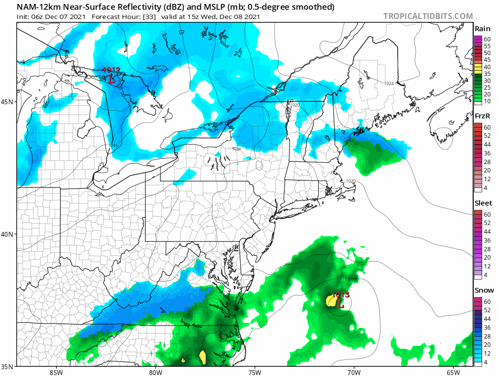
We then have our next disturbance move in on Wednesday morning. This looks to be more wet than white outside of extreme NNJ. I am keeping my eye on this to see if it can trend a little colder...


At this time I would not count on snow Wednesday but it is a close call for some and we will keep an eye on it.

Things for the rest of the week are on the seasonable side. We will have a storm approaching the region New Years weekend but at this time it does not look like snow. There could be a scenario where rain changes to snow but its too far off.


More sustainable cold then should arrive by next week. This is the period that needs to produce some snow or it just may not be in the cards this year. The weather pattern that is currently causing rain/warm air to enter our region shows some signs of breaking down BUT we need to see if it is temporary


Above is the pattern for first week of Jan. Notice the blue is bleeding more east. IF this happens we can see some real cold air finally and snow. Issue can be if the models trends back to the west with this. Time will tell. Stay tuned .

Friday, December 24, 2021

Merry Christmas!.....Snow on the Ground for Some, Rain for Christmas Day

 Merry Christmas eve! Many across NNJ, PA and NE woke up to a white ground this morning. At my location in NW NJ, we got about 1.5". Really makes for a nice scene this Christmas Eve. The bad news is it will wash away tomorrow as some rain will move in for Christmas day.

We then go into a wildcard period next week. Areas south of NNJ likely see more rain next week when areas to the north have the chance at some more snow. In particular, interior New England should see more snow accumulate with areas like Southern New England to NNJ a battle zone of snow/ice and rain.

Lets take a look...

Warmer air moves in tonight and it rains Christmas day...


This will take out the snow that fell this morning sadly.

We then have an interesting situation Monday evolving. High pressure will establish itself to our northeast, holding in cold air as a disturbance approaches from the SW. There is a shot areas like PA NNJ etc see snow from this.


Due to the strength of the HP, this disturbance will weaken as it approaches but it still can drop a few inches Monday in PA and NW NJ. It will be a close call on if this system can keep up its strength.

We then go into a very volatile setup as warm air tries to surge from the SE next week but is held off in New England by cold air holding firm. This will set up a battle zone and at this time it appears Ski Country can do well. For areas to the south, it will be harder to snow...


The reason this is happening is there is a massive ridge of HP out in the pacific (red blob) which is causing all the cold air and storm energy to originate in the west. This will dump insane amounts of snow over the western ski areas....


The energy then tries to eject east towards our region. Warm air is ahead of it except in New England, as there is enough HP over Canada to reinforce cold air due to the block over Greenland. This sets up our battle zone of rain and snow.

In order to see snow further south, we need to see that blue in the west move eastward and knock down the warm air. This MAY happen by around the turn of the New Year...


For areas in the Mid-Atl and southern New England if this verifies this will be the short for more sustainable winter weather. We need to see if this verifies or if it just defaults back to its current state.


Stay tuned. Merry Christmas!

Friday, December 17, 2021

Friday Weather Pattern Update: The Stage is Set for Wintery Period End of December

 The only question will be does it want to snow. Good morning.

We have currently been in a mild period of weather across the east. That pattern will start to end this weekend as New England sees a snowfall event then other areas to the south start to transition to colder weather Christmas week.  In fact, we have a very impressive "blocking pattern" that is projected to develop the last week of December. If this verifies it will be hard to escape the end of the month without some snowflakes or even a storm. 

Lets take a look...

Currently we have warm air (red) over our area from the south...


This has been the pattern all week, hence the mild conditions.

By later this weekend, a storm system brings snow to New England. This will be the start of our pattern change...


Storm moves in Saturday late afternoon into Sunday morning. Many areas will see a few inches of snow and ski areas may see up to 10"...


We then enter the period that could see more action further south. One of the most important factors for a chance at snow in the Northeast closer to the coasts is high pressure over Greenland or a Negative NAO pattern. As next week evolves models develop a very impressive -NAO as seen by red or high pressure over Greenland below...


Why is this important? It slows down the jet stream in the east giving the chance for storm energy to consolidate and also tends to lock in cold high pressure systems ahead of storms.


The first period I have my eye on is around the 23rd for something to spin up. The models do not show anything yet, but it bears watching due to this block and two strong impulses of energy in the eastern 1/3...


If nothing develops then, this pattern will continue through the end of December and will give us a few more shots for stormy weather to develop. In fact, some models even show some flakes Christmas Day..


No guarantees, but with an end of December pattern like this at least we got a shot...


Stay tuned.


Tuesday, December 7, 2021

Tuesday Morning Update: Weaker Trends, Mostly Non-Event Tomorrow

 Good morning. The storm system has trended weaker and offshore overnight. I am gaining confidence this will be mostly a non-event for most areas. That means just a few snow showers tomorrow with very limited if any accumulations. The only region I can still see a few inches accumulate is SE New England.

Here is my updated map:


Unless you live in the blue area I would expect zero issues tomorrow. If you live in the blue zone it still will not be too bad as snow will not fall to heavy and be scattered. 

This is pretty much a non event.


You can see from this one model above, most of the energy stays off shore then we see that back end band hit eastern New England. This has been pretty consistent on models and will cause an inch or two with more in the mountains. 

After tomorrow we then hit a mild period starting this weekend through at least the following week. There are then hints that our next wintery period will be around Christmas but those details need to be worked out. 

Stay tuned. 


Monday, December 6, 2021

Monday Night Update: Forecast Looks Good, Next Update in the AM

After today's model runs I like the current forecast for Wednesday's light snow event. Outside SE New England, I really do not see this as more than 1-2 inches max for most folks. For SE New England, there will probably be a localized area that sees over 4" . Timing is Wednesday morning into the afternoon. 

For most in PA and NJ, I do not expect any major travel delays. Roads should stay warm and it will not be snowing hard enough to overcome that. In the higher elevations of NW NJ, I can see a light cover on the roadways as it will be a little colder. In RI, Eastern Mass, and CT there could be bigger delays in the afternoon.


More tomorrow. 

Monday Update: Shot at Some Snow on Wednesday

 Good morning. For last few days I have been tracking a snow threat for the Mid-Atlantic and Northeast. Nothing major, but definitely the chance to whiten up the ground and cause a few inches to fall in some areas. 

Rain will move though today then things get cold. It is this cold front that our next wintery storm system will try to ride along. The big question is how close to the coast the storm center gets. Some models are showing a non event with a few snow showers while others have a few inches falling. Below is my first estimate of what I think can happen. Timeframe is Wednesday morning into the afternoon. I will be updating this daily so stay tuned...


There continues to be a spread in models with this. Some have a non event while others show a few inches falling. My forecast is based on how I think things will trend. If I need to adjust to no snow that will happen tomorrow. Keep in mind this is preliminary. 

I will have an update around 8pm tonight.


Sunday, December 5, 2021

Sunday Note: Watching for Snow Shot Wed

 Good morning. Over the last few days I have been tracking a potential chance for snow on Wednesday. I will have a post tonight breaking down my thoughts. 


Stay tuned.