I will have more details tomorrow morning on all of this. Granted my updates will be on Mountain time so a little later than usual.
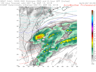
Models have been hinting at a coastal storm for Sunday night into Monday but there is a high spread.
The GFS is the closest impacting model for the region..
The European on the other hand has been persistent on keeping this way south...
At this time I think the Euro is too extreme with this solution. But I am not ready to buy the GFS yet either.
Bottom Line: There is the chance at more snow on Monday but this is far from a lock. Given I will be out of town that increases the likelihood of it occurring.
Stay tuned for more detailed updates on this.


I don't think anyone in their right mind is hoping for another big storm for the northeast after what we went through with the last two all within two weeks.
ReplyDelete