WINTER OUTLOOK 2023 IS NOW LIVE

The 2023 Winter Outlook

Sunday, December 31, 2017

Sunday Morning Storm Update: Next 24 Hours Tell The Tale

Summary:

  • There still exists the potential for a significant storm middle of this week
  • Models are currently still offshore with this storm system 
  • Over the next 24 hours better data sampling should help the models more accurately depict what will happen
  • This is where we should see more trends (east vs west) develop
    • any western trends would mean more impacts
  • At this time I assign a 60% probability of impacts for eastern New England and maintain my 50% for ares more in the interior from the Mid-Atlantic into New England


Good morning. As we continue to monitor the evolution of a potential significant storm system for the middle of this week, important data points should help iron out details over the next 24 hours. 

As stands now, not much has changed since yesterday. All the major models are showing the storm develop just off shore with some impacting eastern New England. Ensemble members of these models also continue to indicate this has some room to move west. The key to all of this will be how these models trend with updated data sampling as our two pieces of energy start to come into range...


In many cases we start to see trends emerge as this energy is sampled better by the models in the 72-84 hours up to an event.


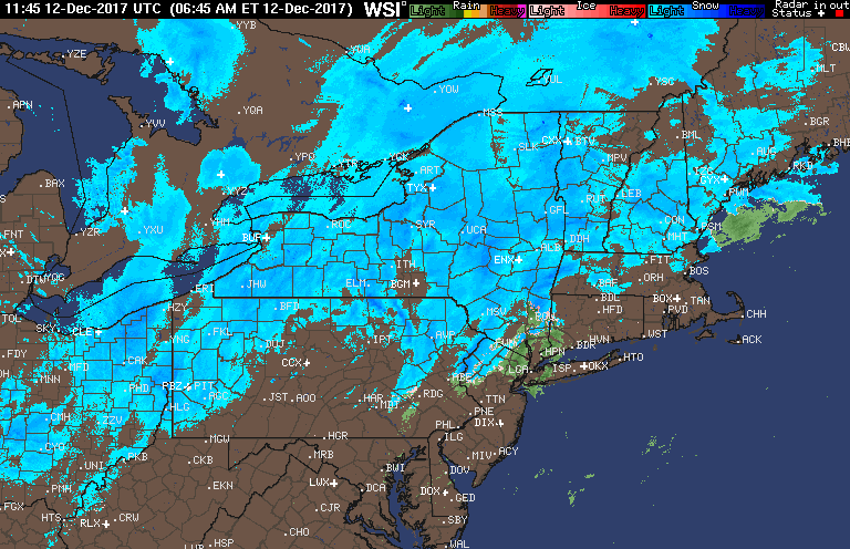
You can see how this energy is starting to come together by Wednesday...


The whole development of this storm comes down to how these two interact.  We will evaluate this today ,especially as the updated models come in this afternoon.

So to the current projections. Here are the model projections...

GFS...off shore but a strike to eastern New England


European...west of the GFS with a bigger strike from the eastern mid-atlantic to eastern new england


The ensemble spread (GFS model with varied inputs to test for error and reran multiple times)...


You can see some members still indicate a western spread (seen by red low dots).

What is even more impressive is how strong some of these members are. Anything in red below is sub 980 low pressure...


My image from 2 days ago also still stands, we need that trough to stay off the west coast (#1) as it will help pull storm west. It has started to trend this way but does still have more to go.


So we will wait and see how things look tonight when this updated sampled data comes in. At this time I assign a 60% probability to a hit along eastern New England and maintain my 50% probability of a hit more inland from Mid-Atlantic up into New England.


Stay tuned.

Saturday, December 30, 2017

Saturday Morning Update: Some Trends in Right Direction for Storm Development

Summary:


  • Potential for big storm middle of next week
  • Models do NOT currently show a storm impacting the region but show one close enough to watch
  • Recent trends have moved west but we still would need to see further corrections for impacts
    • Given this is still over 100 hours away it is worth watching
  • I assign a 50% probability of impacts at this time
  • Stay tuned


Good morning. A nice dusting of snow is currently on the ground with flakes still flying. With temperatures at 15 degrees at least it feels like winter. 

So about that storm I discussed yesterday for middle of next week. Well if you remember I put this image up...


The focus was to pull back the trough (blue)  off the west coast which would help the developing storm in the east to trend west. 

Here are the latest model trends with that....


You can see as of now there is a trend to pull that back more west in the last 24 hrs. The result is the storm now being projected closer to the coast albeit we still need further trends...


I'll tell you one thing though, what ever ends up developing will be a bomb. All three jet streams are in play here...


Looking at the model ensembles (main weather model with inputs adjusted and rerun multiple times to test for potential error) you can see the strength of some of the low pressure centers...


The numbers represent low locations and their strength. Notice the sub 960 lows on some of these! Also notice the western spread of the lows. This can mean (isn't always the case) that this can trend more west. 


So the bottom line is this, we got some big time potential to track for middle of next week. Recent trends have gone towards a storm closer to the coast, but we still need more shifts west for impacts. At this time I assign a 50% probability for a big storm to impact somewhere along the east coast Wednesday and Thursday.

Stay tuned!

Friday, December 29, 2017

Friday Afternoon Update: Very Cold, Light Snow Tonight, Storm Next Week?

Good afternoon. I am back from my ski trip now so normal posting will resume. The theme so far post Christmas has been the bitterly cold weather we are experiencing. It is currently 18 degrees in Morristown NJ which feels like 75 compared to the sub-zero temps I experienced in Vermont. 

The bitter cold will continue over the next 7 days at least as the air is sourced directly from the arctic...

This means well below normal temps...

This is very impressive and colder than I expected for December. Bundle up, many more single digits to teens to come for lows heading into the New Year!

So the next question naturally is will it snow?

Well it will snow lightly tonight into tomorrow morning. I do not expect much accumulation however...

Maybe up to an inch in spots but mainly a dusting.

We then turn to the middle of next week. Models were showing a potential significant storm for Wednesday and Thursday but have since backed off....

This can still change since we are over 5 days out. There actually are some players on the field here that could produce a fairly significant storm but its all about the timing....


We will have a strong impulse of energy (#2) dive in towards the Gulf.  This then can phase with northern jet stream energy (#3) if it is not too progressive. In order to slow down #2 and allow #3 to catch it we need to see #1 or the pacific trough pull back west. IF this happens we can have a major storm blow up and move up the coast.

The models are not showing this but there is enough time left for this to change. If I had to put a probability I this I would say 40% chance at this time. 

That's all for now, stay tuned for updates. 

Tuesday, December 26, 2017

Tuesday Update: Gone Skiing

Good morning. I am about to head up to a ski trip to Stowe, VT so posting will be limited until Friday. However, I will still comment on anything that evolves over the next few days.

At this point there are two periods to watch, Friday and then at the turn of the New Year.

As of now models have Friday as a weak wave of precipitation with a low pressure system to our south...


This still does have some time to trend north just enough to cause light accumulating snow. If taken verbatim above its just a dusting. Still some unclear details. The European for example handles the energy differently and has a Saturday impact for eastern New England.

We then turn to Monday where some models are showing a potential bigger system...


Still very unclear as well as the GFS is only model doing this.

Bottom line: there is a lot of the table next 7-10 days but the details very unclear. The upper air pattern is loaded to produce storms but its just a matter if things align properly.

Stay tuned will comment briefly while I am on my trip.

Monday, December 25, 2017

Merry Christmas!

Merry Christmas everyone! It may not be much but I do have a white scene out my window this morning in Morristown NJ. Looks like many areas saw a light dusting in NNJ with areas to the NW 1 to 2 inches. Here are some of the first reports...

Latest radar shows heavy snow in New England currently. When this is all said and done we will tally the final totals.

I am still watching the end of this week for storm potential. Will have a post on that tnt or tomorrow morning.

Again, Merry Christmas! I hope everyone enjoys the day with their family.


Sunday, December 24, 2017

The Final Christmas Forecast: Adjustments Made


Merry Christmas everyone! Above is my final forecast for tonight's storm system. Snow will start late tonight for areas north and west of I-95 and start as rain for all other areas SE. Some mixing then occurs in the 1-2" zone before it goes back to all snow between 4-7am for all areas in light blue. For the Interior (darker colors), this will be an all snow event with moderate accumulations Christmas morning. 

The reason for the reduction in accumulations is a tongue of warm air that will move in aloft tonight...


This will change any initial snow to mixed/rain. As the cold air sweeps in again behind the storm snow then falls again to end the event. I wish I had better news guys but the weather will always do what it wants.

Remember, earlier this week the models had no storm. The storm ended up developing as I expected and discussed in my videos, but we got too much of a good thing. This will wrap up too close to the coast which is why the warm air gets pulled in. How ironic! The weather will always be a great challenge. 

However, models are indicating that a strong band of snow can develop just before daybreak for areas that see the rain and mixing. You can see below that they have been fairly consistent (image shows past several model runs 5am Christmas morning) with projecting this band...


This is the reasoning behind the 1-2 inches. If this occurs things whiten up just before daybreak! Lets see what happens.


I am still watching a potential storm system for later next week. The details are still unclear and I will likely have a post dedicated to this tomorrow.

Saturday, December 23, 2017

5pm Update: Final Forecast Map Out Tomorrow Morning

No changes to my thoughts from this morning. There will be rain and mixed precip for all light blue areas and areas on the southern portion of the dark blue Christmas eve late night. This however will turn back to snow before daybreak, especially in southern New England. For the light blue areas of NJ, its a very tough call. Rain or maybe some light snow moves in Christmas eve night then it turns to rain, then we need to see if by Christmas morning there is enough wrap around to give that coating of snow when the cold air moves back in. 

Bottom line: If you live in anywhere but NW NJ this whole forecast of a coating depends on if we get a band of snow between 4am and 8am Christmas morning.  For NW NJ there will be mixed precip back to snow. For Southern New England, rain at the coast back to snow at the tail end Christmas morning. 


I will evaluate the final trends of this system and reflect it in my morning update.

Saturday Morning White Christmas Update

Good morning! Below is my updated snowfall map for Christmas eve into Christmas Morning...


As you can see I made a few small tweaks for coastal areas where warm air does work its way into the storm.  However, even if you are only in the light blue zone I do expect the flakes to be flying come Christmas morning. Even a coating would do the trick for a white Christmas!

Stay tuned for a more detailed evening update at 5 pm!

P.S. I still am watching the late week storm threat. Big potential is still on the table. 

Friday, December 22, 2017

Friday Evening Update: White Christmas for Many!

Video below breaks down my latest thoughts for the snow event on Christmas morning (how nice it is to be able to say that). I will have updated map out sometime tomorrow morning on this.


Friday Morning: Who's Been Dreaming of That White Christmas?

Good morning. For many in the Northeast those dreams will come true Christmas morning as the storm system I have been discussing now has a better chance of materializing. Here is my INITIAL impact map. This will be updated again tomorrow morning...


Summary:


  • Snow likely on Christmas morning for many areas of the Northeast
  • For the Mid-Atlantic (light blue zone) expect some flakes to fly but little accumulation to maybe an inch in some spots
  • Further south no White Christmas this year sorry
  • Snow starts late in the night on Christmas Eve and ends by late morning to early afternoon Christmas Day
  • Changes to this forecast are still possible including minimal impacts
    • Stay tuned for updates all weekend
  •  We then turn out eyes to a potential significant storm later next week
    • More on this to come


Latest models are starting to come around to my thoughts that a storm system develops along a stalled front on Christmas Eve....


I still think this can change a little as the energy responsible for this storm still needs to be ironed out by the models...


If this trends sharper then the storm is stronger and produces more snow. If it trends flatter then this turns into just snow showers. Right now I am thinking the middle ground makes sense and that is reflected in my forecast map. 


We then turn to a potential big ticket storm threat later next week. The atmosphere will be absolutely loaded to produce something big but I will wait to this weekend to start to discuss those details. 

I will have a few comments later tonight on all of this. 

Thursday, December 21, 2017

Thursday Night Quick Update

So I still am waiting till the critical 72 hour period before I really double down on my ideas of snow on Christmas or back off the idea if things do not look as promising.

Here is where the models stand now for Christmas day...

GFS- Snow showers and heavier snows up in New England...


European- weak low pressure, light snow...

Canadian- moderate snow....

Again the focus more of the northern Mid Atlantic and New England. The reason we are not seeing the stronger storm currently modeled is because the upper air energy is not modeled to be dynamic enough...


Models always struggle to handle how hard these shortwaves of energy dig or amplify until around 72 hrs before an event. That is why I am still watching this threat closely. At the very least, I think flakes will fly its just a matter of how many.

On another note, there are very strong signals in the long range for a potential very big storm at the end of next week.  I will discuss my thoughts around that over the next few days as well. All the classic ingredients needed will be on the maps its just a matter of if they come together and create the "big one". More to come.

Thursday Note: No Changes For Now

I have no changes at this time to my thoughts from yesterday morning. There is still the chance for a wave of low pressure to develop Christmas day that can result in snow for many areas. The focus still would be north and west of 95 and up in New England. Models are doing their usual back and forth, but the major players are still in line to make this possible. In the wake of what every happens on Christmas bitterly cold air will move into the area through New Years with the shot at more action. Lets track the Christmas threat first before we go there.  

I will have an updated forecast out later this afternoon.

Wednesday, December 20, 2017

Wednesday Update: The Initial Christmas Forecast

The video below discusses my first attempt at the Christmas forecast. There is still the potential for the flakes to fly for many areas. We are at a period where forecasts have to start being made. Although this can change, these are my thoughts as of now.

Here is a summary:

  • Moderation in temps continues through the weekend
  • We then have a storm system passing to our west on Saturday
    • This storm system brings in a cold front that should get established just off the east coast
  • We then have to look out for a storm system to develop along the front for Christmas Eve to Christmas day
    • Details still unclear but I like certain dynamics I see such as a negative trough which can allow a surface low to develop
  • As of now I would say the target would be I-95 north and west based on the fact the true arctic air is still on the tail of this system
  • Much can change but that is where I stand at this time

Enjoy the video...


Tuesday, December 19, 2017

First Stab at Christmas Forecast Tonight

I will take a closer look at storm development and potential track. A lot of solutions on the table right now ranging from rain to snow to mix to nothing.

Monday, December 18, 2017

Monday Pattern Update: Moderation in Temps This Week, Then Back to Cold

Good morning. As Christmas day is quickly approaching I figured I would take everyone through what to expect over the next two weeks.

In Summary:


  • Temperatures will moderate this week, especially by Saturday
    • Expect highs in the 40's and into the 50's by Saturday
    • This will be due to a storm system passing to our west pulling up warm air from the south
  • In the wake of this storm system a pool of bitter arctic air begins to work its way to our area by Christmas day
  • Expect a seasonable to colder than normal Christmas with the chance at snow if things align properly
    • This will be discussed more in my video below
  • In the period up to New Years expect very cold conditions with at least one chance at snow

The short video below discusses my thoughts...


Here are some points from the video.....

The pattern comes down to a few major factors and it is important to consider these factors when also trying to interpret model printouts.

Here are the factors...

A MJO pattern (pattern of tropical thunderstorms that influence the jet stream) that is going into a favorable phase for cold to push east

A Eastern Pacific Oscillation (EPO) that will be very negative

Colder than normal air available in Canada

Very volatile models (sign that pattern is in a period of transition)

As a preface to the video check out the kind of model chaos we are seeing. We go from a projection like this...


To this for the same peroid....


The seesaw will continue however we need to use some commons sense. At -EPO pattern as seen by higher than normal pressures in the Gulf of Alaska is supposed to result in this...

Which looks a lot like the second model image. Also, the MJO going into phase 8 is supposed to result in this...

The cold air that is certain to move into the heartland next week is off the charts (double negative digits)....


This is due to air being discharged directly into the United States from the North Pole, thanks to the EPO. This will bleed to the east by Christmas or just beyond. I do not buy the models that keep the cold air locked to our west. 

Check out the strength of this arctic high!...


More to come this week. Stay tuned. 

Sunday, December 17, 2017

Pattern Update Tonight 8pm

Will discuss the moderation in temperature this week and where the cold air and storms will be centered Christmas week.

Friday, December 15, 2017

Friday: Suprise Snow Today

Good morning. We have a quick hitting surprise snow event later today. A wave of low pressure will try to intensify at the last second off the DE coast later today. In its wake it will drop light to moderate snowfall in spots. Here is my forecast:


In the dark blue zone I expect widespread 2 inch amounts and up to 4" in isolated spots. In the light blue zone 1 to maybe 2 inches can be expected. 

Storm develops early this afternoon...


Its a quick hitter and should be over by the evening. 

The reason for this developing at the last second is a slight shift in the amplification of upper air energy. This ended up causing enough dynamics in the atmosphere to develop this small storm...


Enjoy the flakes today! I will be focusing heavily on the next 2 weeks as a very storm pattern looks to develop. I warn you tho it will boom in some areas bust in others. Stay tuned!

Thursday, December 14, 2017

Thursday Update: Who Doesn't Love This Start To The Day!

Good morning! This is my view this morning as I write this...

Who can think of a better way to start your day with a solid 2 inches of fluffy snow?Region wide we saw 1-2 inches last night from our clipper that moved through. Snow will start tapering off rapidly now and leave in its wake a white scene for today.

Temperatures stay cold through this weekend, then some moderation occurs next week. There will still be the chance for unsettled weather which we can hone in on a later post, but the real period we need to watch is Christmas week....


We will have an impressive ridge develop over Alaska which will drill cold air down into pattern. This is a feature we cannot ignore. On the other hand we have a southeast ridge that tries to fight the cold air. In between you get a very active storm track. I do think models have been overdoing this southeast ridge some. The target area here is the northern mid Atlantic into New England for multiple chances at winter precipitation Xmas week. Yes some areas see mixing and rain with this pattern in the mid Atlantic but we can not nail those details down this far out.

Bottom line:

No blow torch in sight. Some moderate next week (still shot at unsettled weather) then active storm track develops for the following week.

Tuesday, December 12, 2017

Tuesday Night Pattern Update: What to Expect Over Next 2 Weeks

Wednesday afternoon note: 

*1 to 2 inches region wide tonight. Snow starts around 9pm ends before dawn.  Expect morning commute slowdowns as it will be very cold.*


Wednesday Morning:

Please check out the video below from last night for my thoughts on the long range pattern. We will have very cold arctic air over the region the next few days so bundle up! Temperatures are currently in the teens with a bitter wind this morning. Also, tonight we see snow move through the region as a weak clipper swings through. Expect up to 1 inch of accumulation in spots. 


<<<<<<<<<<<<<<<<


The video below breaks down the period leading through Christmas. I discuss the potential for temperature trends as well as snowfall. Enjoy...


Tuesday Weather Discussion: Snow to the North, Long Range Questions

Good morning. There are no changes to my snow forecast from yesterday. Snow is currently breaking out to the north and will continue all day. The jackpot areas will be the northern mtn ski resorts that should see over a foot of snow.  You can see on the radar below how the snow is spreading into the area....

Later today the heavy show shifts to interior Maine, Northern VT and NH as the low intensifies...


On the way backside cold air causes lake effect snows and snow showers for the areas that are being hit right now. Overall a ski country special.

From there we have a clipper that can drop some light snow down in areas further south on Wednesday night and Thursday...

At this time most models are weakening this significantly as it comes more east which leaves the mid-Atlantic areas with just the chance at snow showers at this time. It bears watching however as these clippers can be sneaky. 


We then have to watch out for a storm that passes to our south Friday night...

There has been some speculation this can end up coming more north and effecting the northeast with a decent snowstorm. I am not sold on that idea at this time however. For one, the GFS is the only model that has suggested that and what it is showing in its upper air pattern is not backed up by any other models. Of course that doesn't mean this cant still trend to be a snowstorm but trying to be objective and look at all the forecast data suggests we should not get too excited on this one.

The GFS has handled the upper air energy a little differently as it tries to eject the southern piece out ahead of more ahead albeit it has started to trend less with this...


This can change but at this time I wouldn't expect the storm on Friday into Saturday.

From there the Jury is still out in week 2 and beyond. Models are indicating this pattern can default back to a more la nina look with a ridge in the southeast...

However, we cannot ignore that massive ridge over AK. That can deliver some serious cold so I am not sold on any warm ups yet leading up to Christmas. Maybe just a few days of moderation. I know I have been trying to get you guys a White Christmas so lets see how this plays out. There will be alot of storm activity next week and beyond its just a matter of where is it rain and where is it snow.

I am going to have a video out tonight at 7 or 8 that breaks down my long range thoughts in more detail.