- Rain enters the area late tonight
- Cold air quickly crashes in from west to east
- Western counties of NJ changeover to snow first, then areas closer to the coast by around day break.
- The storm will have to overcome the warm air at the surface which will take some time
- However, I expect it will start snowing hard enough for ALL areas to see accumulations from this on grassy surfaces.
- Elevations over 600ft will see roads become snow covered quickly
- Areas at lower elevations will see some road impacts but treated surfaces should make out ok
- Snow ends by late morning
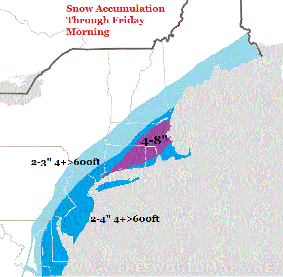
- The jackpot is southern New England as seen by the purple.
- In the wake of this, I am tracking a potential major system for Tuesday.
- More details in my video below
Here is my map for tonight into tomorrow AM (mainly grassy surfaces):
The video below briefly discusses this along with my thoughts on the main storm I have been focusing on for next week. Enjoy!
No comments:
Post a Comment