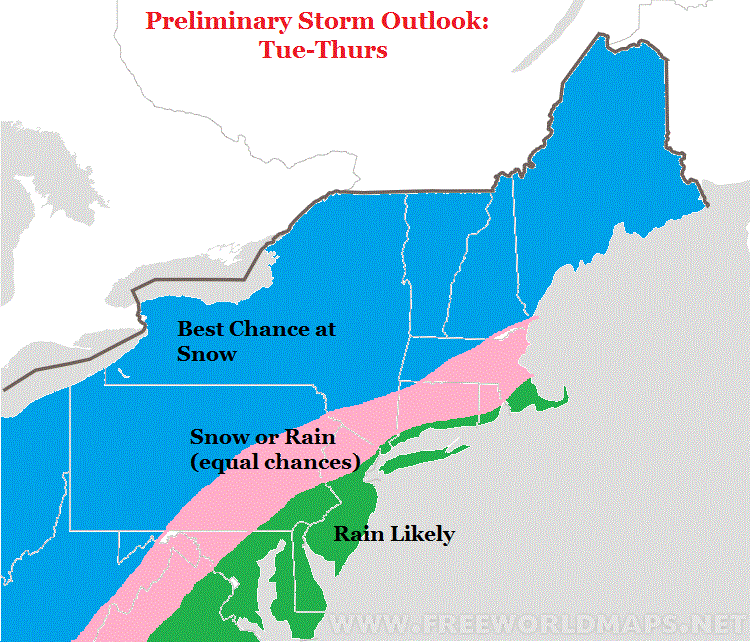
Here is a summay of my thoughts:
- Major storm effects the eastern 1/3 next week
- Big questions remain over where this storm will track
- Some models have it tracking well inland giving the whole region a rain storm
- Other models have a colder and snowier solution for NW of I-95 into New England
- THIS IS NOT A BIG CITY SNOWSTORM
- Why? Simply because we do not have the factors in place ahead of this system to hold in cold air and dictate a track far enough off the coast
- For areas north and west of interstate 95 I would say you have equal chances right now at rain vs snow
- This is not the ideal set up but there are scenarios where folks in these areas can see snow next week
- Interior New England, I really like the chances for snow
Here is a map summarizing my preliminary thoughts..
The video below gives my updated take on how this will evolve. I tried to keep it no longer than 3 min.
No comments:
Post a Comment