Sunday, March 31, 2013

Wednesday, March 27, 2013
When Spring Temps Will Arrive and Winters Last Gasp
Good evening. As you can see I have transitioned this website to spring mode. I have not determined what the format of posts will be yet, so I will begin to play around with a few ideas such as a weekly video discussing the weather for the weak ahead, long term temperature trends, hurricane development and of course thunderstorm outlooks. But I am not at that point yet. For now I will keep the post format the same.
Looking ahead into the next three weeks, we will see slightly below average temps overall, with chances at precipitation early and late next week. I think next week will be the winters last attempt to give the country winter style storm setups mainly in the interior northeast. For Easter Sunday the weather should be beautiful with temps in the mid to high 50's.

In the wake of Easter, a storm system will develop and spread a cold rain through our region on Monday, with some snow up in VT and NH. After this unsettled weather, all eyes will be on a possible costal storm for that Friday. This is our last shot at a storm that in theory could produce snow for our area (do not bet on it at this point). Here is what we are looking at...

Looking ahead into the next three weeks, we will see slightly below average temps overall, with chances at precipitation early and late next week. I think next week will be the winters last attempt to give the country winter style storm setups mainly in the interior northeast. For Easter Sunday the weather should be beautiful with temps in the mid to high 50's.
In the wake of Easter, a storm system will develop and spread a cold rain through our region on Monday, with some snow up in VT and NH. After this unsettled weather, all eyes will be on a possible costal storm for that Friday. This is our last shot at a storm that in theory could produce snow for our area (do not bet on it at this point). Here is what we are looking at...

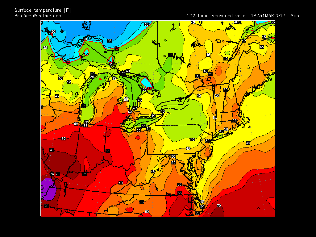
There are two separate disturbances that want to develop...one coming from central Canada and another in the gulf (circled areas). Depending on the speed and timing of these low pressure areas they have the potential to merge along the east coast. Given the strong ridge projected in the west (positive PNA) and the high pressure to the north in Greenland (negative NAO) this usually results in storms coming up the east coast. I have marked all these areas on the map above. Also, if you look just off the coast of California you can see a deep tough (blue and green colors) usually if you have a deep trough like that off the west coast the same occurs just off the east coast. The model however is showing the east coast through not as intense (no green mixed in with the blue). I think with time either both will be weak or both will be strong. The latter would produce a big storm. We are 10 days out and one or all of these factors can change and result in no storm or a bigger storm than what is shown. Snow would not be out of the question with the more extreme solution. I will keep you updated on this..
So when is spring coming? I think after next weekend spring will be here. There is evidence that temps will snap into the 60's and possibly 70's for the week of April 7th due to a strong high pressure system sliding down into the center of our country.
In summary:
1. Nice Easter weekend
2. Rain on Monday
3. Possible big storm on the following Friday (snow not out of question)
4. Week of April 7th spring temps will arrive.
Thanks for checking in.
Tuesday, March 26, 2013
Monday, March 25, 2013
Bust For Northern Zones
Its official...precip not heavy enough to pull down enough cold air so any snow will not stick today north of I-78. My forecast for these regions was wrong (not afraid to admit that).
In reality I could have backed down on this yesterday, but I choose to stick with it. To many by reading local forecasts there was a big contrast from what I was saying. Keep in mind there are many times when the pendulum swings the other way as well (more times than not). That was the case for the big storm in early Feb and many of the other events I predicted. When it is all said and done the southern part of my snow map will be fine, but not north of I-78. . I will give myself credit for calling this to effect the mid Atlantic a week prior..it just did not shift as far north as I expected.
I will post tomorrow what the final totals are..Snow will wind down this evening.
In reality I could have backed down on this yesterday, but I choose to stick with it. To many by reading local forecasts there was a big contrast from what I was saying. Keep in mind there are many times when the pendulum swings the other way as well (more times than not). That was the case for the big storm in early Feb and many of the other events I predicted. When it is all said and done the southern part of my snow map will be fine, but not north of I-78. . I will give myself credit for calling this to effect the mid Atlantic a week prior..it just did not shift as far north as I expected.
I will post tomorrow what the final totals are..Snow will wind down this evening.
Monday Morning...I like what I have, Northern Zones Like I said Close Call
Good Morning..overall the storm is on track. I will give fair warning for bust potential in our northern zones. My forecast is not perfect, I will be the first to admit it. I think when this is all said and done our central and southern zones fall correct with my posted amounts but to the north we will be on the lighter side. I will note however, that the actual precipitation shield is a litter further north than what the model has by about 30 miles. This can make things interesting as things unfold today. lets take a look at some radar images...


Above is the storm currently. You can see the heavy precip in south jersey. This is mostly all snow and has started to accumulate in these areas. North of I-78 a flake has not fallen yet. This is expected and by this afternoon the radar should look like this...

As you can see the north part of our area is right on the fringe, and the central and south are getting hammered by heavy snow. So although it will snow everywhere that I am sure of, the accumulations to the north are going to come down to the wire. Yes, I know the national weather service has only had us in the 1-3 inch amounts in north jersey since yesterday and my amounts are higher. However, lets not forget I posted my initial map for all regions on Friday long before anyone else. So although I will be wrong in some areas, I hope people who read this will appreciate the stance I took days in advance on this system. Lets see how this plays out today and if we get thrown any surprises. I will update again around lunch time...thanks for checking in.
Sunday, March 24, 2013
Evening Video Update..Summarizing My Thoughts on Storm
This will be a very interesting storm to track tomorrow. The video above summarizes my thoughts. Someone will get a high total (excess of 6in) with this system. If you like snow there will also be some disappointments as well due to the fact there will be a sharp cut off in precip on the northern edge of this system. Right now nobody knows exactly where that northern edge will set up. We are talking a difference of 25 miles. In any regard the surface storm out in the Atlantic tomorrow will be very strong so the potential is still there. Enjoy video.
I will update again very late tonight with any additional thoughts.
Subscribe to:
Posts (Atom)