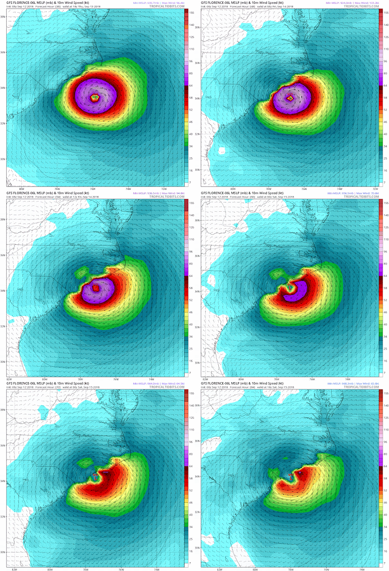
This is currently a powerful Category 4 storm and could strengthen to a 5 before it hits land. Just awful news for folks in the projected epicenter which looks to be the NC coast and parts of SC where a long duration hurricane (24-36 hours) is expected from Friday night to Sunday morning. Outside of those areas, the outer bands will have impacts into VA and also northern GA.
Here is updated National Hurricane Center projections...
Projected landfall will be on very early Friday morning and this storm will batter the coast with hurricane winds for at least 24 hours if not 36. This is why this could be such a devastating storm. Below shows GFS wind speeds over 48 hours from Thursday night to Sunday afternoon...
Notice how it hits and basically stalls over the NC and SC coast reeking havoc on the shoreline. This is not something to be taken lightly. Those purple wind speeds are over 75mph and in the initial frames over 100mph.
In terms of track all the models now have this making landfall in NC. The only question remaining is how long does this stall out and can it move faster into land which would be a good thing. It appears there is still a chance for that, but it is not guarantee as seen by loop above.
In terms of rainfall, over 2 feet of rain is possible for immediate coastal areas as seen by bright yellow...
Lets hope the people on the NC and northern SC shore lines have evacuated by now. This is no joke.
More to come tomorrow.


Hey Will, I'm a big admirer of your blog, and have introduced a number of people to it. But I think it's worth pointing out that neither hurricanes nor wild children nor impulsive politicians "reek havoc." They may wreak it, but never reek it.
ReplyDelete