Thats right, that pesky little disturbance I mentioned yesterday looks like it want to produce on Saturday.
The disturbance moves into our region early Saturday morning from the north...
This should cause snow to fall from I-78 north into New England. As this disturbances intensifies, low pressure looks to develop off the coast Saturday afternoon...
This is the tricky part, the exact placement of the heavy band of precip/snow is going to be tough to nail. We have evidence of something called an inverted trough that can develop. These are known for producing a narrow band of heavy snowfall. The model above shows it developing of NNJ into SE NE later on Saturday afternoon. However, other models vary with its placement.
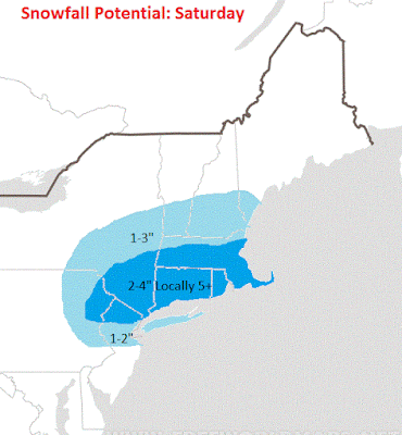
My first estimate of what this system can produce is below....
I will update this map tomorrow morning as necessary. It may be March, but the weather pattern we are in is more like early February. The weather will always surprise you.
More later tonight, be sure to check in.


what happened to the "early spring" ?
ReplyDeleteGood question..no one expected this.
Delete