WINTER OUTLOOK 2023 IS NOW LIVE

The 2023 Winter Outlook

Monday, October 28, 2013

Siberian Snow Cover a Big Factor In Winter Predictions

I briefly mentioned in a post last week that there has been extensive research at MIT by a individual named Judah Cohan that suggests the amount of snow cover over Siberia in the fall months especially October is usually a precursor to the temperatures of the United States during winter. The main reason being that the increased snow cover strengthens the Siberian High pressure which results in high level warming over the stratosphere which ultimately breaks up the polar vortex (coldest weather in the Northern Hemisphere) and displaces it further to the south near the US. 

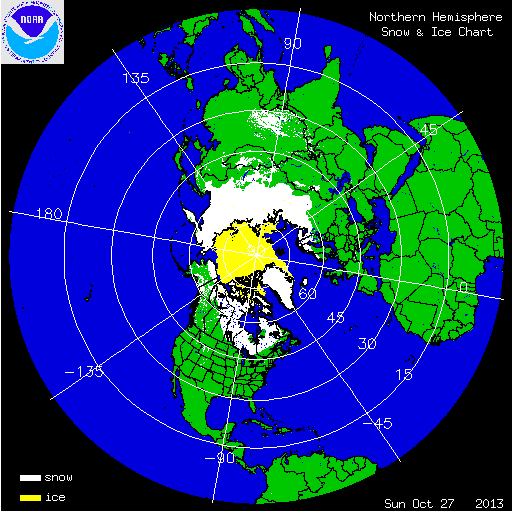
Looking at current snow conditions over Siberia we are running above normal. In fact September snow cover was 9th most recorded on record for Eurasia. Here is a graphic showing current snow cover..


As you can see most of Siberia is covered in snow which is a good sign if you want cold air for winter. To take it a step further Cohan developed a model to project what the winter temps would look like based on Snow Cover, here was last years forecast..


Here were actual temps for last year..


Pretty impressive accuracy and the main component as i mentioned is snow cover. 

With all of this being said there is a factor that needs to be mentioned that can counteract this above average snow cover and it is a pattern called the quasi-biennial oscillation (QBO). In simple forms this is a weather pattern that represents easterly and westerly zonal winds over the extreme altitudes of the equator.  When the westerly's propagate downward from the stratosphere it tends to favor less high pressure over Greenland and the Arctic. When this is in its opposite easterly phase more blocking is favored.

Right now we are in a westerly QBO which does not favor blocking to the north which is essential for an active winter. Here is what westerly QBO years have looked like..This graphic shows the correlation. Blue and purple colors are a negative correlation meaning a west QBO results in low pressure not high pressure over the Arctic. 


As you can see a west or positive phase QBO results in a negative pressure correlation to the north (low pressure) and a positive correlation to the south (high pressure, warm conditions.) However, with above normal snow cover, low solar activity, very weak warming in the El Nino region and model projections for this winter, which all favor blocking, there are a lot of moving parts to look at. Before I release my final winter forecast (coming within a week) I want to figure out which of these factors have been most dominate over the last few decades.  

Friday, October 25, 2013

Northern Hemisphere Snow Cover Highest in over 30 Years...A Precursor to a Cold US Winter


Notice difference from 2007 between snow in Siberia. Here is a graphical chart green is the average..


Oh and by the way for the global warming crowd take a look at the purple region and how much the northern hemisphere ice has increased. 

Wednesday, October 23, 2013

November 2013 Temperature Forecast


Above is my expected temps for November. I think the jet stream will be weaker than it currently is with more of a flat flow through most of the month. Most of the action weather wise will be in the Pacific Northwest and possibly a storm or two developing for the mid-section of the country.

I do not expect any big weather events for the East Coast thorough at least mid-month where the jet stream may become more amplified. We are going to be entering a positive AO/NAO which is not favorable for colder than normal weather over our area for this time period. A lot of forecasters are calling for a slow start to winter and a mild December, but I have a hunch the winter might start off with more action than that for first two weeks of December that then things should settle down until Jan. 

This current cold pattern should last another 5 days before the more seasonable weather arrives. Keep your eye on the lake regions as some higher elevation towns can get several inches of snow over next few days. 

Monday, October 21, 2013

Latest High Resolution Model Temps

As a addition to my post below check out recent temp projections from high resolution model for highs Wednesday and lows Wednesday night..


Low's


Cold air stays locked in next 5 days at least from Wednesday. 

Sunday, October 20, 2013

Sunday Night Pattern Overview: Cold Air Very Close

The pattern change I have been discussing is underway and will be noticeable for our area by Wednesday with much colder conditions in the 50's. That is 5-8 degrees below normal for this time of year. The local weather outlets have already begun to hype it. This pattern change is due to a few large scale features including a big ridge out over the west coast, and blocking over the top in Greenland. These features are seen below...notice the large green area which represents the polar vortex displaced over Northeastern Canada..


This setup allows cold air from Canada to flow into the eastern third of the country. Combine this with an active southern jet and we have a setup that can cause a northern stream disturbance to tap into some gulf moisture by middle of the week. 


This setup will cause a cold rain for our area and some light snows inland of a few inches possible especially over higher elevations. In addition the low pressure system spinning over Canada will cause some lake effect snows this week. 

So how about the rest of the month into November...

Long range guidance keeps a trough over the east around Halloween..


This will keep temps on the colder side for this time of year through month end. I suspect this pattern will break by November where some seasonal conditions will come back into play. Until then we will see very active weather associated with that trough with the potential for multiple chances at snow over the lakes region and possibly interior Northeast.

My winter forecast still looks good based on recent data. I will be updating that sometime in Nov. I think the low sun activity will be a big factor based on recent research.

Stay tuned for updates on mid-week system which could becoming interesting.

Pattern Update Tonight..A More Detailed Look at Next 15 Days

Wednesday, October 16, 2013

Next Week's Temperature Departures From Normal


All departures are in C. Expect up to 5 degrees below normal for our area in F. Bringing temps into the mid 50's. Pattern change will be noticeable by next week and should continue through the end of the month. Many chances for precipitation through this period, I will provide more detail later this week. 

Monday, October 14, 2013

Keep an Eye on Storm Tracks Next 60 Days

Good morning, as I have been mentioning over last week a big pattern change is coming to colder weather over the east this weekend. This pattern change will be due to a strong ridge developing over the Gulf of Alaska and Western Canada with will in turn drive the jet stream down into the eastern part of the country bringing cold Canadian air into the mix. Below image is latest model forecast for next weekend.


Notice the blue extending down from Canada as the cold air bleeds into the country. Notice however the brown area just off the east coast. That is a stubborn Southeast Ridge in the Jet Stream and it is a variable that might have to be worked into my winter forecast. When you get ridging off the coast like this in many cases it pushed storm track more towards the great lakes and produces rain for the east despite strong blocking high pressure to the north. I am going to keep a close eye on storm tracks next two months and see if most of them follow this path due to this ridge. A storm looks like it might want to develop late next weekend as shown below..


If you look closely you can see two pieces of energy one diving in from the north the other from the south. The speed and timing on these two features along with the south east ridge I just mentioned will dictate where this storm will go. Right now it cuts inland which in the winter would be a rain event for our area. I will mention the European model is the only model showing a possible phasing of these two systems this weekend, so this is all speculation at this point.  I think the European is seeing something the other models aren't and i think we will have an inland running storm towards end of weekend. 

In any event the big news is it will get a lot colder, take a look at temperature departures from normal next week..


The core will absolutely be centered over Ohio valley and plains. The east will see some below normal temps but not to the extent of the mid section of the country. For anyone who is familiar with the MJO it supports this set up along with the southeast ridge. 

Thanks for checking in.

@weatherwilly 


Thursday, October 10, 2013

Quick Update

Rain will continue to effect our area on and off getting heavy at times through tonight and tomorrow. The storm now look to be moving a bit faster than original guidance but still will give a large area of 1-3 locally 4 inches of rain from north Jersey down to MD. Saturday looks to be ok for the northern zones. Expect cloudy conditions and maybe a passing shower. The further south you go, the showers will linger through Sat. Sunday should be a nice day.

On another note, the cold weather is coming to the East Coast by Oct 20th as a trough will develop over our area as seen on map below..

More on this next week.

Enjoy weekend. 

Wednesday, October 9, 2013

Update on Coastal Storm

A very wet coastal storm will effect our area Thursday-Sunday. The core of heaviest rains from south to north (DC to NYC) will be between early morning on Thursday and early morning Friday. I am very confident at this time that both these days will be total washouts. The big question becomes how much moisture remains in the area for the weekend. At this time I am calling for showers for all day Saturday and continuing into Sunday for the Baltimore DC area. When it is all said and done expect 2-4 inches of rain with the heaviest core right over the MD region. This storm will form as the result of two separate disturbances merging. The first one being the remnants of tropical storm Karen the other being another wave of low pressure coming in from off shore. Both these disturbances are shown below..

The difference right now between the European model and the GFS is the Euro along with the Canadian really feed the offshore storm into the coastal storm producing a longer wetter event. The GFS try's to separate the two and shoot the storm on the right out to sea. I am not buying that solution at this time due to the fact the model has been playing catch up all week. I think if you reduce the rain amounts on the European a little you have a forecast. In any event we have alot of rain on the way especially the further south you go. The rain should linger and finally clear out by the end of the weekend. 

Tuesday, October 8, 2013

A Closer Look at the Thursday and Friday Storm

Good Morning, a storm will effect our region early Thursday into Friday with rain and wind. There remains a model spread between the European which has been the most consistent, the Canadian, and the GFS which is the least intense. I am going with a blend of 35% GFS and 65% European for my forecast. Lets take a look at the difference between rainfall amounts..

European...


Large area of 2-4 inches of rain.

The GFS..


Hard to see but you can click to make bigger. Keeps heavy rain off shore has up to one inch for mid-Atlantic Delmarva area, much less for Jersey. 

Overall I expect you will see rain and wind start very early on Thursday for the MD and DE areas then spread to NJ by afternoon Thursday. The storm will stall out and spin moisture into our area throughout the day Friday, ending with showers by Friday night. I think the weekend should remain spared by this system. Expect 1-3 inches of rainfall, with the heaviest amounts over DE and MD areas. There will be wind associated with this system especially along the coast with gusts up to 40 mph, less wind the further inland you go. 


I will also mention it looks like a pattern change to colder weather is on the way for the end of Oct for the east coast. More on that later this week.

Thanks for checking in.

Sunday, October 6, 2013

A Wet Week Ahead

We have two rain events that will effect our area this week. One will be a strong cold front that will swing through our area tomorrow night from the remains of the low pressure system that produced the western US blizzard crosses the country. The other possibility looks to be a combination of the remnants of tropical storm Karen combining with a cold front off shore and possibly spinning a coastal storm into our area by the end of the week. 

Here is the front crossing tomorrow night..


This should be cleared out by Tuesday where will will have settled weather before the next potential coastal storm hits our area Thursday and Friday. Model projections from the European model below show what COULD happen..


Storm will be coming in from the east and stall out due to large area of high pressure to the north. Right now the jury is still out on this system it it very well can stay off shore, but the european model has been consistent with keeping the mid-atlantic in its bulls eye.  Here are  rainfall projections by week end..


Large area of 2-5 inches of rain potentially. I will keep monitoring this setup and lock in a forecast once I see some more data. As an aside, another large storm will effect the western US again by mid week and return more snow to the mountain areas of CO and WY.

More tomorrow night, thanks for checking in.

@weatherwilly


Friday, October 4, 2013

Current Radar Shows Set-up I Described In This Mornings Post


Snow to west, super cell storms over Iowa, and a squall line to the southeast. Compare this image to model projection in below's post.

What a Day for Weather

Its a rare occurrence that in one day you will see a blizzard, tornado's and a tropical storm all effecting the country at the same time. Over the next 24 hours Wyoming and South Dakota will see 1-2 feet of snow, Iowa will see super cell thunderstorms that will produce tornado's, the Mississippi valley will see a strong line of thunderstorms, and the gulf states will be effected by tropical storm Karen. The map below sums everything up using the GFS model...


I marked all four features above time valid 8pm Friday night. On the back end of this massive low pressure system you see the heavy snow effecting Wyoming and SD, on the warm side of the storm to the east you see where the tornadoes will develop, just to the southeast you see the cold front producing a squall line of thunderstorms and in the gulf Karen is starting to intensify. 

The biggest threat will be the possible tornadoes in Iowa due to a wind sheer that will take place (winds moving in different directions cause thunderstorms to spin and produce tornadoes).

Take a look at the high level winds in the left pane and the lower level winds in the right pane and how the directions differ (tails indicate direction wind is coming from)..


This will produce tornadoes in Iowa. 

In terms of snowfall take a look at the latest projections, the  models have been very consistent with these high amounts..


That's 1-2 feet with locally 40 inches in some spots. 

Thanks for checking in.

@weatherwilly

By the way, in case you prefer to use the National Weather Service your out of luck..


Thursday, October 3, 2013

Models Really Insisting on Significant Snow event for Rockies and Northern Plains

This mornings GFS run for accumulated snowfall...


Here is the storm near its peak on Saturday..


As it deepens it pulls in enough cold air for snow in South Dakota. Pretty impressive for this time of year. As a side note this storm will produce  tornadoes in Iowa and dangerous thunderstorms downstream as it progresses its cold front into the Mississippi valley. 

More tonight.