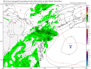
Good morning. We are about to have an excellent start to the work week. Temperatures today and tomorrow will move into the 80's but with very little humidity. This means conditions outside will feel perfect. This is due to high pressure system in the Great Lakes that is causing a northwest flow of air into the region.
Things start to change Tuesday night into Wednesday as a warm front enters the area. From the Tuesday through Saturday time period, we will experience very hot and humid conditions with rounds of thunderstorms possible each day.
As the warm front passes Tuesday night and Wednesday, expect storms to flare up by Wednesday afternoon..
This trend continues Thursday and Friday afternoon as daytime heating causes more storm to pop up each afternoon..
The weekend also looks to be hot, humid and unstable. It doesn't look like we get a relief from this heat until sometime early next week.
Why so hot and humid? The jet stream is going to rise over our area. This allows warm moist air from the south to flow up into the region. You can see this below..
Thats all for now, thanks for reading.


No comments:
Post a Comment