Good morning. Its been a while since I have posted given there has been no winter this year. However, that is about to change with a storm that will impact New England Monday night through Tuesday. At this time I think most wintery precipitation stays north of the tri-state area meaning we see mostly mixing and rain. To the north heavy snow can fall in areas like Mass, VT, NY State, etc.
Lets take a quick look..
Our weather pattern features a block in the jet stream over eastern Canada with approaching storm energy on Monday seen below....
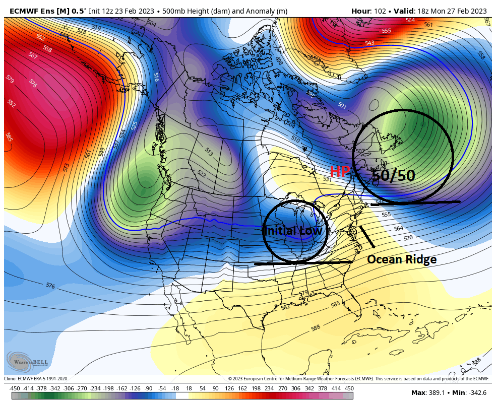
As the initial low or storm energy approaches it runs into high pressure caused by that 50/50 low. This means the storm then redevelops off the New England coast. The whole key to this forecast is how far north this storm gets before it redevelops. I am anticipating it goes a little more north than some models are showing which means the heaviest snow is in my initial target zone below...

I favor the dark blue zone the most for heavy snow with the light blue zone seeing wintery precipitation.
My favorite model so far for this storm has been the Canadian...

Again, that initial low you see over the lakes above then redevelops off the coast. This model shows things more north like I expect.
For NNJ NE PA S CT, I think we see a wintery mix from this. An initial period of sleet changes over to some rain and freezing rain. It can end up being a sloppy mess in higher elevations of NW NJ etc. No impacts I expect for areas to the south or near NYC.
Stay tuned. More tomorrow and frequent updates on twitter as seen on the right hand pane.
No comments:
Post a Comment