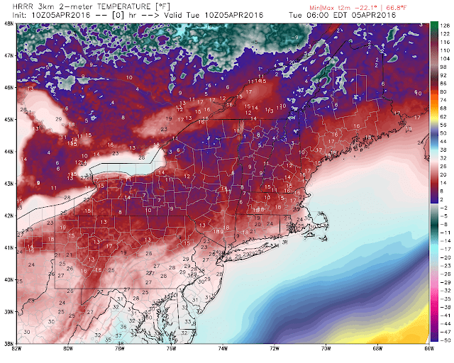
This is as impressive as it gets for an April arctic outbreak. Highs today will not even break 40 in many areas. Yesterday, many up north saw a nice snowfall..
So will the cold air end? The answer is no overall. We get a little moderation in temps Thursday and Friday just for things to get cold again for the weekend into early next week!
The reason or all of this is the impressive upper air pattern that is underway...
The image above shows why it is so cold. This is as impressive as it gets for April. We have a rising jet stream out west and an impressive area of high pressure over Greenland developing. This traps cold arctic air over the east as seen by the deep blue colors. This pattern stays persistent through early next week at least! If this is mid winter we would be completely frozen.
Due to this big area of high pressure developing over Greenland (-NAO pattern). A lot of energy will be getting trapped along the east. This means the chance of unsettled weather, in particular snow, is possible over next 10 days. We will have an arctic disturbance bring in more snow showers for New England this Sat..
The big storm idea will not hold as the initial frontal wave on Thursday night will be too strong.Expect rain showers Thursday as the front moves through.
Check out where temps could be Sunday morning as our second round of Arctic air gets underway..
At this time it does not look like this pattern breaks until at least the middle of next week! Mother nature acts in strange ways and I think we all are seeing proof of that right now. I hope none of you put away the winter jacket yet because it will be needed!
More later this week.


Rubik's cube has been broken- I think. 6 inches of snow in two days is the most I've seen all winter.
ReplyDelete