
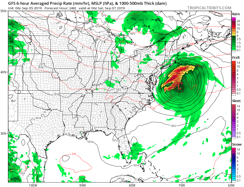
As this moves up the coast areas from coastal SC to NC will see heavy rain, hurricane force winds and a surge of water which will cause problems through Friday.
Here is updated NHC cone...

The updated wind gust swath is below...notice the coast gets in close to core of highest winds...

By this weekend the storm is off mid Atlantic coast...
By then, it will just be some gusty winds and showers for areas near coast. The Cape may see more than that and we have to watch closely how this tracks.
That's all for now.
No comments:
Post a Comment