WINTER OUTLOOK 2023 IS NOW LIVE

The 2023 Winter Outlook

Monday, September 28, 2015

Special Monday Night Tropical Update: Big Cause for Concern

Video below discusses the potential for a tropical storm if not hurricane to effect the eastern seaboard this weekend. A lot of details need to be worked out including strength and track. However one detail has a lot of compelling evidence and that is inches of rainfall between now and Monday. We could be talking over 4" in spots. The flooding potential alone is enough to have me concerned. We still are over 1oo hours away so for now lets just evaluate the potential.

Video below breaks it all down. Updates will be out from me daily. I will start to try to nail down the finer details by Wed or Thursday. 


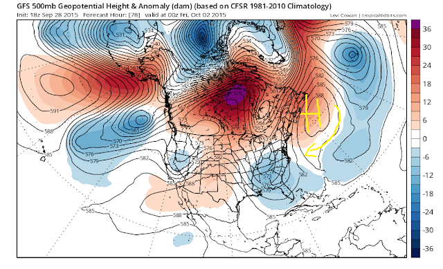
As a footnote for those who are more interested in the technicals, this pattern alone is what is allowing me to believe some of these model projections. All models are signaling a big blocking area of high pressure in the northwest Atlantic. This acts like a pinwheel and causes any developing storm to make a left turn into the coast. The image below shows this.


1 comment: