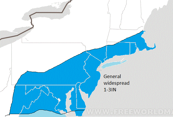
Since it will be so cold, snow ratios will be 20:1 so it will not take much liquid to give us an inch or two. Expect widespread accumulations of 1-3 locally 4 inches with this event. Event will start early Friday afternoon and last through the evening. Expect minor travel delays.
This winter has been hard for those who like big storms. First it was the lack of cold air and now the question will be since we should have the cold air through Feb will any big storms develop? I would like to think so, however it does not seem like the uncontrollable forces want it to snow heavy this year. The trend has been for these small rinky dink storms that give us a few inches. If in the next 3-4 weeks we do not see a major snowfall event then I think its save to say it was not meant to be this winter. Just looking at the climate pattern however, logic tells me we have a very decent shot in Feb.
We will have to wait till the Jury is out..more later
No comments:
Post a Comment