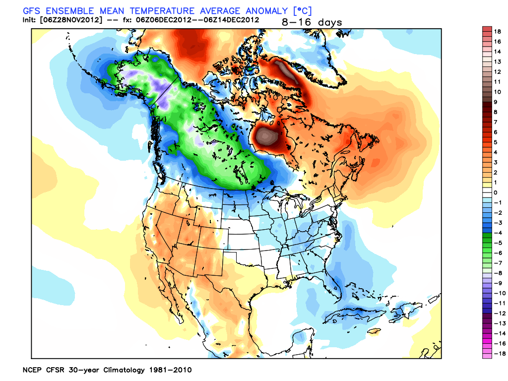
Above you can see what the GFS model is predicting for temperatures in the Mid December time period. Notice along with the below normal temps shown on the east coast, there is also an enormous amount of cold air building up in central and western Canada. This is called the source region and once the jet stream buckles it allows all of this cold air to flow into the USA similar to a dam breaking. Usually when I see this along with some other signals I will show you in a second It tells me cold air is on its way. Now lets take a look at the NAO index.

source:weatherbell.com
The blue line is what the observed value of the index was (already occurred) and the black line shows the forecast for this pattern. The NAO is very low right now, will rebound entering the beginning of December then crash again heading into mid month. This gives the East Coast a good shot at a favorable Storm setup mid month. Many times north east storms occur when this pattern is in its transition phase meaning when it is on the move from negative to positive. You can see from the 1st of December to the 6th of December it is making this transition. Which gives us the potential to see a storm develop around the December 6th time period. Here is what the upper atmosphere will look like at that time.

source:weatherbell.com
Notice the trough over the east coast with the ridge in the west (blue vs orange). Now modeling does not have a storm at this time just has a strong front coming through, but I wanted to show how there is a chance but I am making no perdition at this time.
Finally, lets put all of this together and have a little fun and look at what the long term climate model is showing for snow cover for the middle to end of December. This is far to overdone, but It is exciting to see none the less and shows that the idea of a white Christmas is on the table. Check this out, each box represents the same model but run with a few different variables changed as you can see much of country is covered in snow. Again this is overdone, but can provide a clue...

source:weatherbell.com
In summary, things will warm up and quite down over the next week. All eyes are on mid Month where we will have a favorable atmospheric setup for cold and stormy conditions giving us a chance at a White Christmas. If there will be any action before this period it will occur around the 6th of Dec. Stay Tuned.
No comments:
Post a Comment