Here she blows right now...


You can see the projected hit (middle of the cone) just to the south of the Outer Banks as a major Cat 3, likely a 4 hurricane. I still expect this to wobble a little to both ends of those cones. The track should be nailed down in next 48 hours.
Lets take a look at the different projections...
GFS..more of a direct Outer Banks hit...

Euro more consistently a little more south...

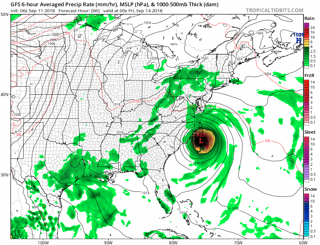
The loop above is from Friday morning (main impact time) to early next week! Notice how it hovers over the coast. This is where the first 24 hours will be brutal with hurricane winds. From there flooding becomes an issue as feet of rain can fall in hardest hit spots...

As far as landfall winds, the models do differ but a Category 3 would be a conservative bet here. Looking more like a Cat 4 however..

Now considering we still have a few days before projected impact Friday morning...there still can be a slightly escape route here. Notice the northeast spread on some ensembles of the GFS...

Don't get your hopes up, even if this does trend northeast and miss a direct hit, there still will be impacts.
It all comes down to that high pressure I mentioned that will sandwich the storm so it cant move as seen in red surrounding it...

Just not a good scenario at all here guys. By early next week a upper level trough is projected to come in and sweep this thing out if it does linger this long as seen by the high winds approaching from the west below(think of it like a highway of wind that will sweep it out as it swoops down)...

Thats all for now. More tomorrow at some point.
No comments:
Post a Comment