

Now the impacts will really get underway and flooding rains and storm surge slam this area for the whole weekend. Below is estimated storm surge in feet...

As you can see over 9 feet of water projected for some areas from the surge along. Combine that with feet of rain and you can see how wind is the least of our concerns right now...
The storm will now just linger as a hurricane for most of today then become a Tropical Storm. Again, the wind is not so as much a problem here as the slow crawl this storm takes...
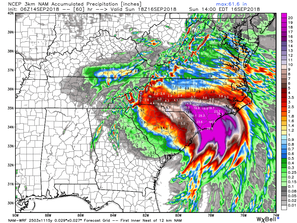
This image shows simulated radar though Sunday afternoon!

Notice how slow this moves hence all the rainfall that is projected.
As I mentioned the other day, the reason this storm is moving so slow is due to the fact it is sandwitched between high pressure...

Lets hope for the best.
No comments:
Post a Comment