
Here is a summary:
- Brutal arctic air arrives tomorrow and lasts through Friday
- Highs will only be in the low 20's Thursday and Friday with lows in the single digits to teens!!!
- Winds will also be whipping making wind chills sub-zero in many spots
- Snow breaks out in most regions very early Saturday morning (pre-dawn)
- At this time it looks like this initial burst of snow can be heavy and will stick very quickly given the frigid air mass ahead of it
- As we approach mid-morning into early afternoon the snow changes to rain for most areas as warm air surges in
- I expect however that most of the liquid falls as snow prior to that happening
- In dark blue zone expect 3 to 5 inches with over 6 in the mountain ranges
- In the light blue zone expect 1 to 3 as a changeover occurs quicker
- In the green zone expect an initial inch of snow changing to rain fairly quickly
- Temps warm up for Sunday reaching the high 40's to low 50's
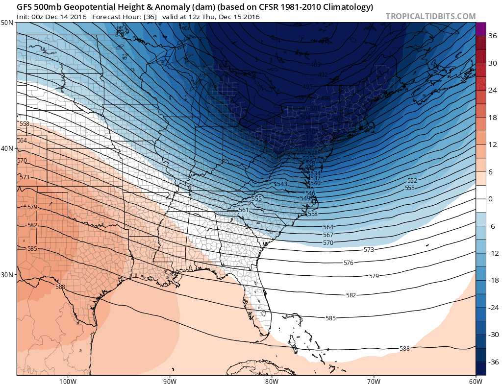
Arctic front arrives tomorrow as the polar vortex skirts by to our north (very impressive)..
Snow squalls (intense short bursts of snow) will hit scattered areas and can make their way to NJ tomorrow as well with the passage of this front..

Now on to the storm..
Most models agree the snow arrives early Saturday morning..

It then picks up in intensity by dawn...

By late morning/early afternoon the warm air surges in..

What ever falls gets melted significantly on Sunday as temperatures will be mild. We then have more action to monitor for next week.
More to come, keep checking in. I will have a video out late tonight or tomorrow morning breaking it all down.
No comments:
Post a Comment