Lets turn to what I believe will be our next POTENTIAL threat. I am starting to focus on around a week from today for a potential significant storm to effect someone in the Eastern 1/3 of the nation with heavy precip/snow. What we will have is a very active southern jet stream that is going to open up its faucet and spray moisture up into the country. Energy coming off of the Pacific jet is going to try to combine with this moisture somewhere near the Gulf of Mexico and try to bring a moisture rich storm up through the eastern states. The question is how does this storm phase and will the polar jet get involved to give us a triple phased system along the east. Last nights GFS shows the three jets trying to line up...

This would produce a storm similar to this...
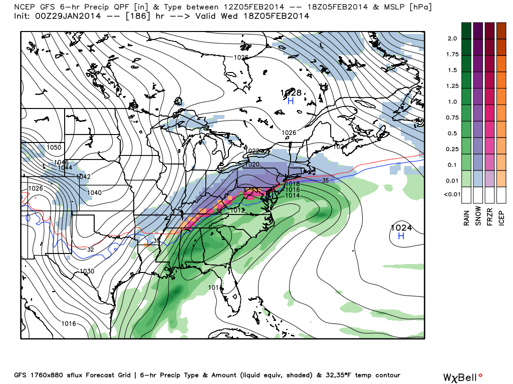
Total precipitation amounts of this...

I think you can see the moisture I am talking about with this system. It bears watching. The models will keep shifting with this and it is possible we get rain for our area and snow more to the west. It is too early to say at this time. I will keep updating as this evolves.
No comments:
Post a Comment